
The National Weather Service in Reno has issued a Fire Weather Watch for the Sierra Front, effective from Thursday afternoon through Thursday evening. This alert highlights the potential for dangerous fire conditions due to gusty winds and low humidity across several areas, including Carson City, Douglas, Storey, Southern Washoe, Western Lyon, and Far Southern Lassen Counties.
Key Details:
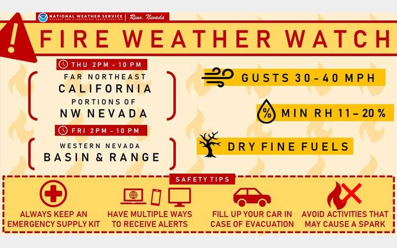
Winds: Southwest winds are expected to reach 15 to 20 mph speeds, with gusts up to 35 mph. Gusts could be even higher in wind-prone areas, reaching up to 40 mph.
Humidity: Relative humidity levels are forecasted to drop to between 11% and 20%, creating a dry environment that could easily fuel wildfires.
Duration: These conditions are expected to last for 3 to 5 hours during the late afternoon and evening on Thursday.
Potential Impacts: The combination of strong winds and low humidity increases the risk of fires rapidly growing in size and intensity. Such conditions can overwhelm first responders before they can effectively contain any outbreaks, posing a significant threat to communities in the affected areas.
Precautionary Measures:
Residents are urged to avoid any outdoor activities that could spark a fire, such as yard work, target shooting, or lighting campfires. Following local fire restrictions is crucial and staying informed by checking updates at weather.gov/reno. For tips on how to prepare for these conditions, visit livingwithfire.info.
With fire season well underway, the public is reminded of the importance of vigilance and caution in the face of these hazardous conditions. Stay safe, and be prepared.


