
The storm doors have opened as much-needed snow returns after a slow start to the season.
The region is again bracing for another potent winter storm after the first significant winter snowstorm brought the season’s first whiteout conditions to the Sierras and several inches of snow even to lower elevations over the weekend. This storm is set to make its mark on Wednesday with a combination of widespread strong winds beginning today and significant snowfall across the region.
Before the arrival of the winter storm, strong winds are expected to sweep across northeast California and into far northwest Nevada. The Reno National Weather Service forecasters say gusts may reach 40-50+ mph in lower elevations, 65+ mph in wind-prone areas, and a 80-100+ mph for Sierra ridges.
Drivers following Saturday’s snowy travel challenges will see similar impacts with this upcoming storm, with snow levels anticipated to reach all valley areas. Periods of heavy snow will bring low visibility on the roadways Wednesday, with potential concerns for whiteout conditions over the passes.
Forecasters predict peak Snow Rates for tomorrow in Lassen and Plumas counties will be between 10 am to 3 pm, if traveling into Reno you can expect the heaviest snowfall for the later afternoon commute home from work and school between 2 and 6 pm.
After the storm passes, clearer and drier conditions are forecasted for Thursday and Friday. However, temperatures will plummet once again, with low temperatures dropping into the teens to single digits in the lower valleys of western Nevada and northeast California.
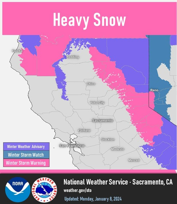
A Winter Weather Advisory is in effect for Eastern Sierra and Plumas Counties, extending through Lassen, while a Winter Storm Warning is issued for the remaining areas of the counties, including Modoc.
Photo: Sacramento National Weather Service


