
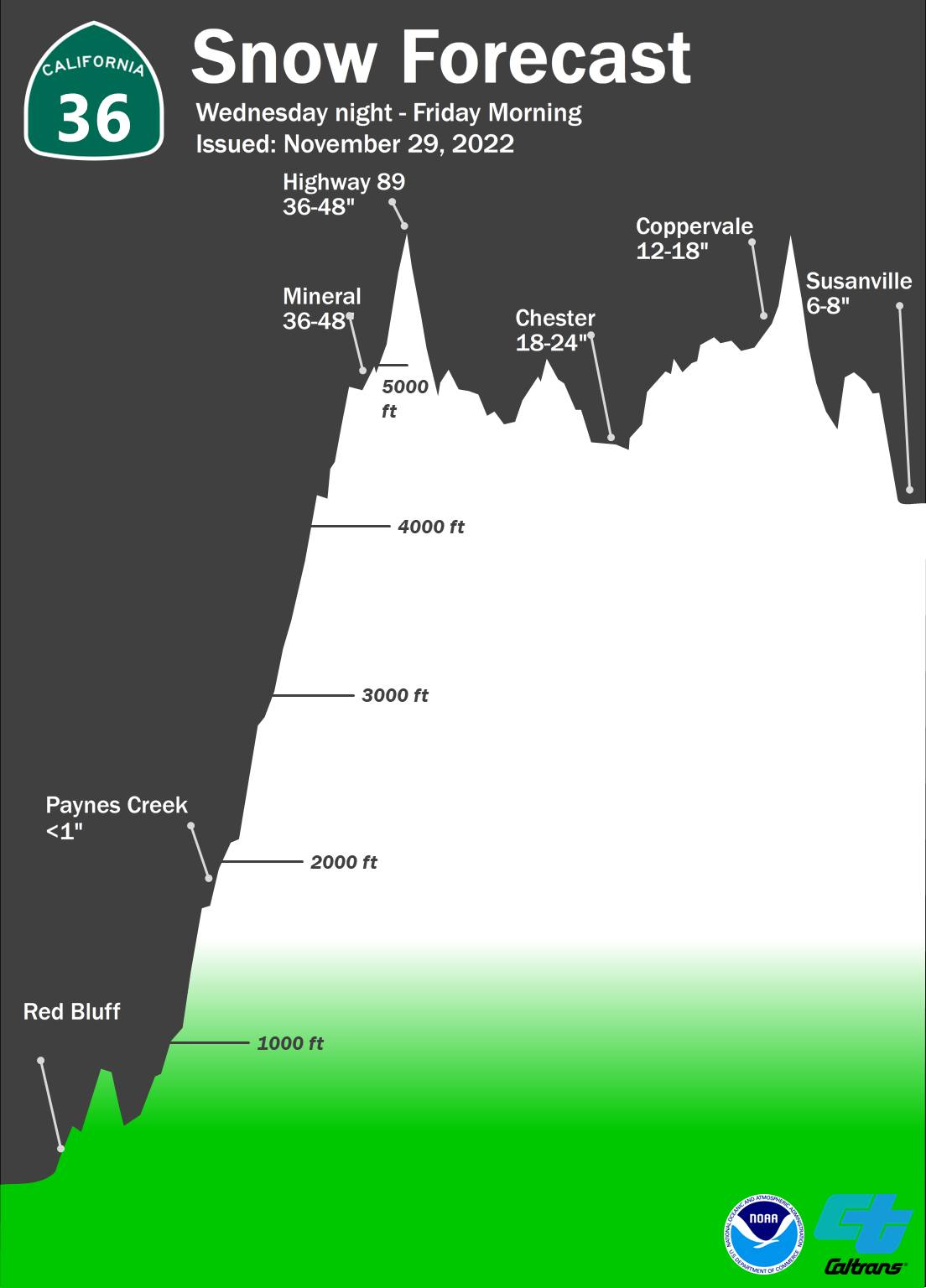
Get ready for a breezy day as the winter storm arrives this evening. The National Weather Service upgraded to a winter storm warning starting at 10 pm.
Heavy snow is expected, with up to a foot of snow expected in most areas and winds gusting as high as 50 mph. The combination of heavy snow and wind may bring periods of whiteout conditions and cause tree branches to fall. Travel will be tough, with hazardous conditions impacting your morning and evening commutes. The heaviest snowfall is expected to arrive on Thursday and could sometimes fall at 3 inches per hour.
The storm on Saturday isn`t looking to be as strong as Thursday`s, but it will be slow-moving and cold. This snow will last from Saturday morning through Sunday night, with the most persistent snowfall likely being Saturday night into Sunday morning.
Additionally, the weather service is warning there is a HIGH potential for avalanche danger from Thursday morning to Friday morning through the Sierras between the Yuba pass, the greater Lake Tahoe area, and down to Ebbetts Pas on highway 4. With an existing weak snowpack, the expected heavy amount of newly fallen snow could result in avalanches in multiple areas. You are cautioned to avoid these areas prone to avalanches through the worst of the storm.


