
A late-season snowstorm is set to impact mountain travel this weekend, bringing up to a foot of snow over the Sierras. Caltrans is urging caution.
Forecasters with the National Weather Service say to get prepared for delays as you head over the mountains starting Saturday morning. A quick passing cold Alaskan storm is expected to plunge the region back into winter.
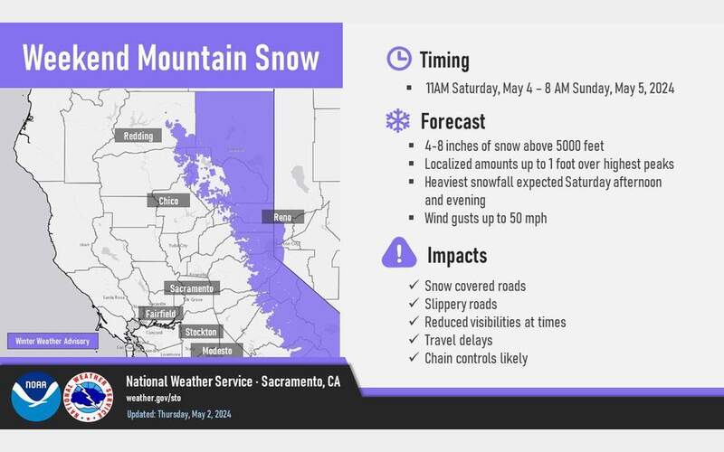
Snow levels will start high on Friday night and drop lower by Saturday afternoon, possibly reaching valley floors by Sunday morning. The weather service has issued a Winter Weather Advisory from 11 a.m. Saturday to 8 a.m. Sunday for areas above 5,000 feet. Snow accumulation is forecast between 4 to 8 inches with localized amounts up to 1 foot over the highest peaks. The heaviest snowfall is expected Saturday afternoon and evening with wind gusts up to 50 mph.
Caltrans advises that you should be prepared for slippery roads, periods of reduced visibility and chain controls.
Additionally, if you are traveling during the storm, with the return to winter conditions in higher elevations, Caltrans advises having a full tank of gas or full electric charge and packing extra supplies in the event of an emergency or if traffic is held for an extended period of time. Those supplies should include snacks, water, blankets, and a flashlight.


