
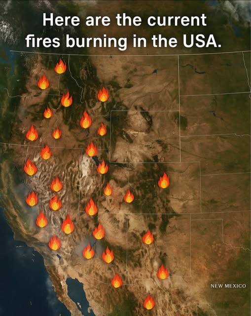
This satellite-based map reveals the alarming spread of active wildfires across the western United States, stretching from California to New Mexico and beyond.
Driven by a dangerous combination of:
- Record-breaking heat
- Severe drought
- Extremely dry vegetation
These fires are escalating rapidly, threatening millions of acres of land, communities, wildlife, and critical infrastructure.
What the map shows: Each fire icon marks an actively burning region, detected using real-time satellite data. The density and distribution highlight just how widespread the wildfire crisis has become.
Why it matters: Climate extremes are making fire seasons longer and more intense each year. Even areas that once saw few wildfires are now vulnerable.
Current hotspots include:
- Northern and Southern California
- Central Arizona
- Western New Mexico
- Parts of Nevada, Colorado, and Oregon
Stay informed & safe:
- Monitor local evacuation orders and air quality alerts
- Avoid outdoor activities in smoke-affected zones
- Support reforestation and fire prevention initiatives in your region


