
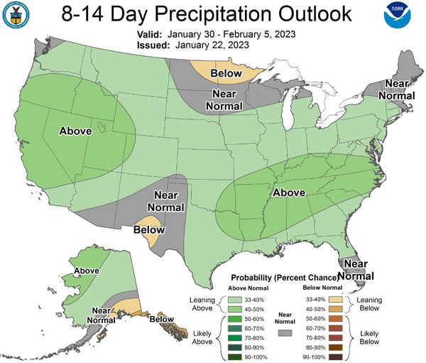
Wetter weather returns as the long-term Precipitation Outlook from the Climate Prediction Center shows more rain may be on the way into the first week of February. Starting next week, predictions show potential for above-normal precipitation amounts over the region.
As a break in these storms allows the ground to absorb the heavy amounts of water received, colder temperatures with high winds bring warnings of high hypothermia risk. The National weather service says through today; you can continue to see high winds in the ridgetops producing hazardous wind chills as cold as -15 to -25 degrees. Through today if you are out enjoying the snow on the ski hill,s be aware of the signs of hypothermia.
Visit the CDC website to protect yourself.


