
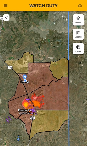
Biscar Fire: Key Details & Updates
-
Size & Containment: The fire has burned 29,752 acres and is 5% contained.
-
Location: Sparked northeast of Susanville near Snowstorm Road and Vincent Canyon (near Karlo / Highway 395).
-
Agency Jurisdiction: Bureau of Land Management – Northern California District.
-
Cause: Under investigation.
Evacuation Information
-
Evacuation Orders (Level 3 – GO NOW):
-
LAS-543,LAS-551-A,LAS-551-B,LAS-551-C,LAS-553
-
-
Evacuation Warnings (Level 2 – SET):
-
LAS-541,LAS-545,LAS-555
-
-
Shelter Information Hotline:
(530) 254-4500 -
Evacuation Map: Available via Genasys Protect.
Road Closures & Detours
-
U.S. Highway 395: Closed in both directions from Smoke Creek Road to 5 miles south of Ravendale (and Termo Grasshopper Road) after the fire crossed the highway.
-
Detour: State Route 139 north of Susanville is available as an alternate route for passenger vehicles (note: not designated for heavy truck traffic).
Response Efforts
Firefighters from multiple agencies are actively engaged with both ground crews and air support (tankers and helicopters) to establish containment lines, suppress spot fires, and protect structures in nearby rural communities. Authorities strongly advise motorists and residents to stay clear of the area to allow emergency personnel and equipment unhindered access.