
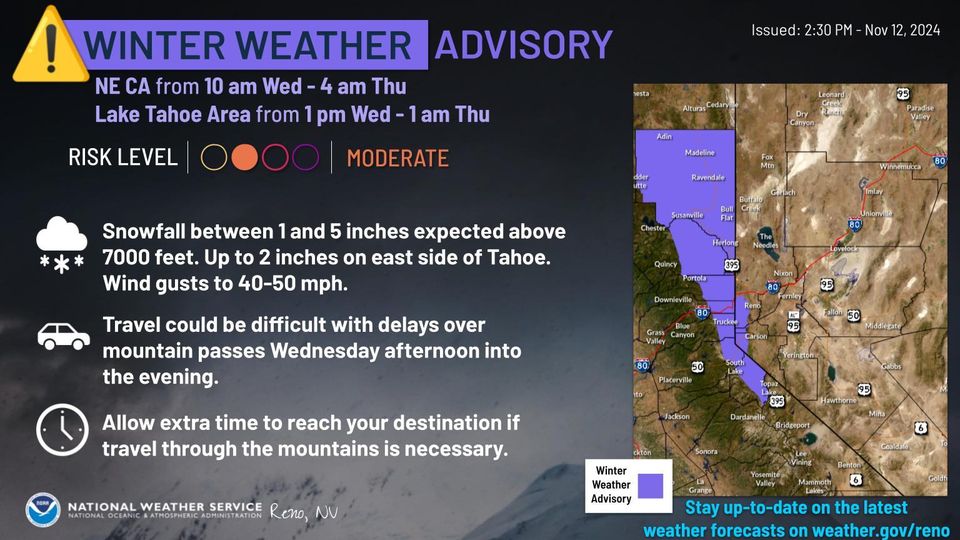
The National Weather Service (NWS) in Reno has issued a Winter Weather Advisory impacting Northeastern California and the Lake Tahoe area from Wednesday morning through early Thursday. Snowfall, slippery roads, and strong winds are expected to create challenging travel conditions in affected regions.
For Northeastern California, the advisory began at 10 a.m. Wednesday and will continue until 4 a.m. Thursday. In the Lake Tahoe area, the advisory is in effect from 1 p.m. Wednesday until 1 a.m. Thursday.
Expected Conditions:
- Snowfall: Snow accumulation is forecasted to range from 1-5 inches above 7,000 feet, with lighter snowfall of up to 2 inches on the eastern side of Lake Tahoe.
- Winds: Gusts could reach speeds of up to 50 mph, potentially knocking down tree branches and reducing visibility.
- Additional Area Details: West of Highway 395, areas above 5,500 feet could receive 2-4 inches of wet snow, affecting Lassen, Eastern Plumas, and Eastern Sierra counties.
You are advised to prepare for slippery and hazardous road conditions, particularly around Fredonyer Summit and Yuba Pass, which may impact the Wednesday evening commute. You should heed any posted travel restrictions and exercise caution by slowing down and maintaining a safe following distance.
For updates on road conditions, travelers can dial 511 from any phone.
Graphic courtesy Reno National Weather Service


