
From a record-breaking snowpack to record-breaking temperatures, Spring may have skipped to Summer. Though as daytime highs peak near 90 degrees, the extreme shift in weather patterns has renewed flooding concerns.
The National Weather Service in Reno issued a flood watch from Thursday to Sunday, May 1st, as melting snow will significantly increase streamflows. Rises are expected to increase daily through the weekend, with the highest potential flows in the evenings and overnight. The flood watch is in place for Susanville, Westwood, Portola, and Loyalton communities.
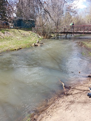
Creeks and streams will run high and fast, and Low-water crossings may be flooded. If you live near the Susan River or other areas prone to flooding, keep watch as flooding is possible.
Memorial Park has already begun to see flooding from Paiute Creek. Much of the back lawn area is saturated, with some areas having significant standing water. Bob Godman, Susanville’s Public Works Director, says the park is designed to relieve the creek during high flows to prevent the culverts under Main Street from getting overwhelmed.
During these unseasonable high temperatures, you are also warned of the dangers of attempting to cool off from the heat this weekend in local waterways as they are running high and fast. The water will also be extremely cold, quickly causing shock, which can lead to drowning.
City and county officials will closely monitor the flood stage of the Susan and Feather Rivers through the weekend to mitigate any potential for extreme flooding.


