
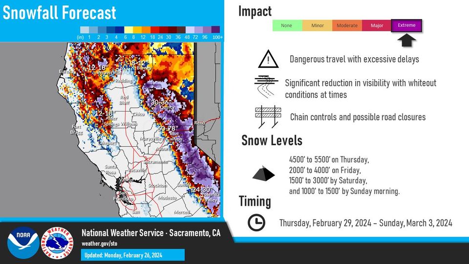
“An event we`ll be talking about for a while,” the National Weather Service says regarding the storm arriving later this week.
Today, the week starts with gusty winds, cooler temperatures, and light precipitation, setting the stage as a strong cold front “crashes” through the area Thursday into the first week of March.
This storm will feature strong winds, substantial snowfall, and cold temperatures. Sierra ridges could experience gusts of 120+ mph and significant snowfall, especially Thursday night through Saturday morning, with high confidence of over 2 feet of snow falling in the Tahoe basin, while Lower elevations may see rain changing to snow, expected to be just above a foot for elevations over 5000 feet.
This can potentially create hazardous travel conditions over higher elevations, impacting your weekend plans.
Although predictions are being made well in advance, those at the National Weather Service said, “This particular storm has shown more consistency than any other systems tracked so far this winter season.”
Photo by Adam Chang on Unsplash


