
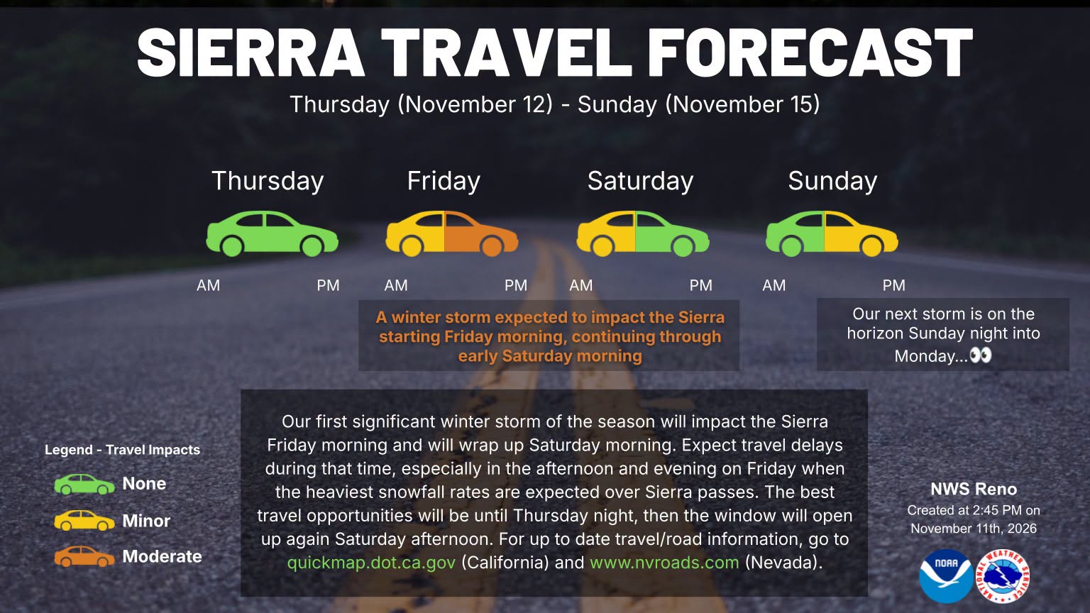
Residents across Susanville and Lassen County are bracing for a series of incoming winter storms set to impact northeastern California beginning late Thursday into the weekend.
While Thursday, November 12, is expected to see daytime highs near 61°F with partly sunny conditions and light winds, local fire officials are issuing early warnings due to shifting atmospheric conditions and expected high winds ahead of the main storm system.
Fire Officials Impose Burn Ban Ahead of High Winds
Effective Thursday, November 12, at 6:00 a.m., CAL FIRE’s Lassen-Modoc Unit Chief and the Susanville Fire Department have announced a temporary suspension of all outdoor burn permits across Lassen, Modoc, and Plumas counties.
Fire officials cite incoming high winds as a major safety concern. Strong wind gusts ahead of cold fronts create rapid fire spread risks and can re-ignite existing burn piles.
“Hot embers can remain hidden beneath ashes for days or even weeks,” CAL FIRE warned in a statement. Residents with existing debris piles are urged to check and douse them until cold to the touch before wind speeds increase.
Weather Outlook: Snow and Wind Arriving Friday
According to the National Weather Service, Thursday will serve as the transition period.
-
Thursday, Nov 12: Daytime temperatures reaching 61°F with mild winds around 6 mph from the southeast. Overnight cloud cover will increase with lows around 33°F.
-
Friday, Nov 13: A sharp drop in temperature down to a high of 46°F, accompanied by a 75% chance of mountain snow and gusty winds.
-
Weekend Outlook: Unsettled weather will persist into early next week with intermittent rain and mountain snow showers across the Honey Lake Valley.
Local public works and emergency management personnel advise drivers to prepare for hazardous travel conditions over mountain passes starting Friday.