
Providing an update on prescribed burning operations by firefighters on the Feather River Ranger District this week on Sawmill Peak and in the Concow Area.
On Sawmill Peak, approximately 1 mile due east of Magalia, everything is within the lines and smoke has dissipated substantially this morning. Area residents may see light smoke in the area. Firefighters will remain on scene all day, working on mop up and using equipment to mix piles to improve fuel consumption.
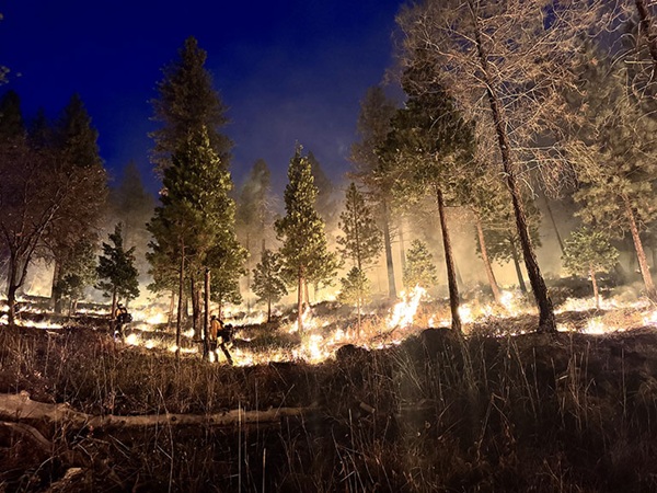
Last night, due to great consumption of fuels in piles and on the ground, fire activity was visible to surrounding communities in the area for several hours during the evening. By 10 p.m., glow from the burning fuels was less visible and consumption continued through the night.
The Saw Mill Peak area was affected by the 2018 Camp Fire. The peak and lookout are right above the community of Magalia, with only a steep canyon in between. The work being done over the past 18 months to prepare the site by the Butte County Fire Safe Council and then for prescribed burning treatment yesterday is an essential step in community protection from wildfire for not only the community of Magalia, but the surrounding area.
The Plumas National Forest appreciates the work of the Butte County Fire Safe Council, the access provided by Sierra Pacific Industries to get firefighting equipment to the site, and the patience and understanding of our local communities and partners while completing this critical fuel reduction work.
In the Concow area, work will continue today, with firefighters planning to treat approximately 100 acres of combined pile burning and underburning in the Concow area between Flea Mountain and Crane Ridge, conditions permitting.
Smoke will be highly visible in the area. Fire traffic will be impacting Rim Road during the prescribed burning operations and over the next several days. The public is asked to use alternate routes or use extreme caution traveling in the area.
Smoke is expected to be visible but not have significant long-term impacts to nearby communities, including Concow, Magalia, Paradise, and Jarbo Gap, as well as Rim Road, Concow Road, and California State Highway 70.
Short duration, minor smoke impacts are expected along Rim Road, Concow Road and neighboring forest roads. Visibility on roads in the project areas may be reduced, especially early in the morning and late evening as smoke settles.
During the evening smoke may settle in lower areas including Concow and the surrounding area. Individuals who are smoke sensitive in these areas are advised to monitor conditions and take precautions if needed.
There are numerous organizations and members of the public who are also conducting their own burning operations throughout the area due to optimal fuel and weather conditions. This is creating other areas with visible smoke and possible smoke impacts that are not associated with Plumas National Forest prescribed burning operations.
There will also be increased firefighting equipment traffic in the area, including on Rim Road, Concow Road and California State Highway 70. Drivers in the area should use caution, watch for fire equipment exiting and entering area roadways, and possible slow traffic.
If weather conditions become unfavorable, including increased or gusty winds in the area, burning will stop until conditions improve. Firefighters will be monitoring conditions throughout the operation.
Sharing a photo from Sawmill Peak last night of firefighters patrolling and ensuring the burning was secure, as well as a photo from today at Concow of the operations along Rim Road near Flea Mountain.


